Physical Address
304 North Cardinal St.
Dorchester Center, MA 02124
Physical Address
304 North Cardinal St.
Dorchester Center, MA 02124

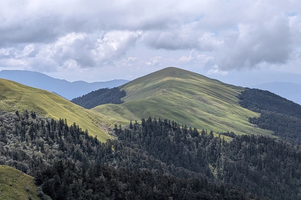
The Pangarchulla Peak Trek is for trekkers who want more than a scenic walk through the Himalayas. It takes you through forests, open meadows, high-altitude terrain, snow and rocky sections before reaching a summit at around 15,069 ft (4,593 m).
This is not a trek where you simply walk uphill, take a few photographs and call it a summit. The upper section can involve steep slopes, boulder fields and snow, depending on the season.
This is not a trek where you simply walk uphill, take a few photographs and call it a summit. That makes the trek interesting from the start, but the real challenge comes on summit day.
So, if you are planning a Pangarchulla Peak Trek, understanding the route, difficulty, weather and preparation is important.
| Trek Detail | Information |
|---|---|
| Peak Height | Around 15,069 ft / 4,593 m |
| Region | Garhwal Himalayas, Uttarakhand |
| Main Route | Dhak – Gulling – Khullara – Pangarchulla |
| Difficulty | Difficult |
| Best Snow Window | Mid-March to April |
| Other Possible Season | Autumn, depending on current route conditions |
| Summit Day | Long and physically demanding |
| Terrain | Forest, meadows, boulders, snow and steep sections |
| Experience Recommended | Previous high-altitude trekking experience |
The exact duration and camp locations can differ between itineraries, but the central route remains around the Dhak, Gulling and Khullara approach before the summit section.
Pangarchulla Peak lies in the Garhwal Himalayas of Uttarakhand, in the wider Joshimath region.
Joshimath acts as an important access point for this trekking area. From there, the road approach continues towards Dhak, where many itineraries begin the walking section.
The trail then climbs through villages, forests and open mountain landscapes before reaching higher camps.
What makes this location special is the mountain scenery. Depending on visibility, trekkers can see major Himalayan peaks and ranges including Nanda Devi, Dronagiri, Kamet, Chaukhamba and Trishul.
And yes, the mountains look impressive in photographs.
They look even better when your legs are complaining and you finally reach a viewpoint.
The standard approach follows the same general trail used for the Kuari Pass region before separating towards Pangarchulla.
A common route structure looks like this:
Dhak → Gulling → Khullara → higher camp/Kuari Pass section → Pangarchulla Peak → Khullara → Dhak
The exact camp arrangement can change depending on the itinerary, weather and trail conditions. Some plans include an acclimatization day near Khullara, while others use different high camps before the summit.
The trek generally begins near Dhak village.
The first section introduces you to the landscape without immediately throwing the hardest climb at you. You move through village areas, forest and mountain terrain while gradually gaining altitude.
Several itineraries place Gulling as the first major camping point.
This part of the trek helps you settle into the walking rhythm. Your body also starts adjusting to the increasing altitude.
The trail becomes more alpine as you continue towards Khullara.
Forests and open sections alternate along the route. Oak, rhododendron and conifer vegetation are found around this trekking landscape, while higher sections become more open.
Khullara is an important point because the character of the trek starts changing from here.
You are no longer simply walking through a forest trail. Higher terrain, open ridges, rocks and snow become more important, especially during the spring climbing window.
The route around Khullara connects with the wider Kuari Pass trekking landscape.
Some itineraries use an acclimatization day here before attempting the peak. This gives trekkers an opportunity to walk at a higher altitude without immediately committing to the summit push.
That extra day can matter.
Altitude is not impressed by confidence.
This is the section that changes the whole experience.
The summit climb can involve steep terrain, boulder sections and snow-covered slopes. Depending on the season, the surface can vary considerably.
The summit day is long. Published itineraries report roughly 10–16 hours for demanding summit attempts, while other route plans put the summit day around 10–12 hours.
Because conditions change, you should never judge the difficulty only by distance.
A short steep climb at high altitude can be harder than a much longer walk on a gradual trail.
The Pangarchulla Peak Trek is generally classified as a difficult Himalayan trek.
The main reason is not just the altitude.
You have to deal with a combination of altitude, long walking hours, steep sections, uneven ground, boulders and, during the snow season, snow-covered terrain.
The summit reaches about 15,069 ft, and the summit day can involve a major altitude gain and several hours of continuous effort.
The upper boulder section is particularly important.
When snow covers the rocks, the surface can become more manageable in some conditions because the gaps between boulders get filled. But deep or unstable snow can create a completely different problem.
That is why the season matters so much on this trek.
It is better suited to trekkers who already have some Himalayan trekking experience.
A first-time trekker may manage the lower approach physically, but the summit section asks for more than basic walking fitness. Long summit hours, altitude and difficult terrain can become serious challenges.
Previous experience on a high-altitude trek can help you understand how your body reacts to altitude and long walking days.
You should also be comfortable walking for several hours on consecutive days before planning this trek.
Timing is one of the most important parts of planning Pangarchulla.
The summit does not offer the same conditions throughout the year.
According to detailed trekking observations, mid-March to the end of April is a key climbing window because the winter snow has settled and the upper route can offer a more suitable snow surface.
This period also gives the trek its classic snow-climb character.
March and April are generally the most important months if your main goal is the snowy summit experience.
By spring, the snow conditions on the upper mountain can become more stable than during the early winter period. The route may still be physically demanding, but the snow can provide a more defined surface over the boulder sections.
April can also bring rhododendron blooms in lower forest sections, adding a completely different look to the trail.
Conditions become different as the snow starts melting.
The upper boulder sections become increasingly exposed, and the nature of the climb changes from a snow-heavy route to a more rocky one.
Some trekking schedules operate during this period, but the exact suitability depends on current mountain conditions and the route being used.
For this reason, don’t choose dates only because a calendar says the trek is available.
Check the current trail condition before travelling.
Winter needs extra caution.
Deep and loose snow can cover the boulder sections, making the summit approach slower and more difficult. Historical trekking observations have found that many winter summit attempts turn back beacuse of these conditions.
So, if your goal is specifically to reach Pangarchulla Peak, don’t assume that more snow automatically means a better trek.
In the Himalayas, more snow can also mean more problems.
A typical Pangarchulla Peak Trek Itinerary can take around six to seven days, including the approach and return, although the exact schedule varies.
Here is a practical example:
Travel to Joshimath and rest before beginning the trekking section. The road journey itself can be long, so keeping this day relatively easy helps you start the trek with better energy.
Drive towards Dhak and begin walking towards Gulling. The trail gradually climbs through village and forest terrain.
Continue uphill through forest and open sections towards Khullara. This is where the mountain begins to feel much more serious.
Depending on the itinerary, this day may be used for acclimatization and a higher-altitude exploration. Some schedules instead move towards another high camp.
Start early for Pangarchulla Peak. This is usually the hardest day, with steep sections, rocks and possible snow. The climb can take many hours, so pacing becomes extremely important.
After reaching the summit, descend carefully. Going downhill is not automatically easy. Tired legs plus loose rocks are a combination nobody needs.
Return through the lower trail and descend towards Dhak. The altitude loss feels good, but don’t rush. Your body has already worked hard on summit day.
Drive back towards the roadhead and complete the journey. Some shorter itineraries combine parts of the return journey, so the final number of days can vary.
The biggest attraction is the combination of a classic Himalayan trekking route with a genuine summit objective.
You get forests and meadows on the approach, then increasingly rugged terrain near the peak.
The views are another major reason people choose this trek.
From the higher sections, the surrounding Himalayan landscape opens up dramatically, with views towards several major peaks of the region.
But the summit is not guaranteed.
Weather, snow conditions, visibility, fitness and route safety can all affect the final climb.
A responsible trekking plan should always leave room for changing mountain conditions.
Your packing should match the season.
Basic essentials include:
For snowy summit conditions, additional traction and technical equipment may be required. Published route information notes that crampons, microspikes and ice axes can become necessary on snowy upper sections depending on conditions.
Do not decide your snow gear weeks in advance and forget about it. Check the actual mountain conditions before departure.
Start training several weeks before the trek. Focus on long walks, stair climbing, running or other cardio work, along with basic leg and core strength.
The goal is not to become a superhero. The goal is to make a long summit day feel manageable.
Practice walking for several hours with a backpack. Also include consecutive training days because the trek does not give your legs a holiday after every climb.
Most importantly, take altitude seriously. Walk at a steady pace, drink enough water and pay attention to symptoms such as unusual headache, dizziness, nausea or extreme fatigue. If you feel unwell at altitude, tell your trek leader instead of trying to prove a point.
If you are comparing a Pangarchulla Peak Trek package, don’t look only at the price.
Check what the package actually covers.
Look at the trek duration, transport arrangements, meals, accommodation, camping equipment, technical snow equipment, permits, support staff and emergency arrangements.
Also check whether the itinerary includes an acclimatization day.
A cheaper package can look attractive until you discover that several important costs sit outside the advertised price.
Read the inclusions carefully.
That five-minute check can save a lot of confusion later.
The Pangarchulla Peak Trek is a serious Himalayan adventure, not just another weekend walk.
Its appeal comes from the complete experience: forests, meadows, high-altitude camps, rocky terrain, snow and finally a 15,069-ft summit.
The most important thing is to choose the right season and prepare for the actual difficulty of the route.
For a snow-focused summit attempt, the spring window around mid-March to April is particularly important because snow conditions are generally more suitable than during deep winter.
If you have previous Himalayan trekking experience, good fitness and respect for changing mountain conditions, Pangarchulla can be a rewarding next step.
Just remember one simple rule: the mountain decides the final plan.
Your itinerary is a plan, not a contract with the weather.